Showing posts with label Trekking. Show all posts

Sunday, March 17, 2013

Hiking Guiterrez Canyon


One of our favorite local trails is only about 15 minutes from our house and is located in a beautiful, natural area called The John A. Milne/Guiterrez Canyon Open Space in Cedar Crest. When my sons have guitar lessons, after they’re done, we sometimes go next door to the trail head parking area and begin our hike.

IMG_8952


And there’s a Hitching Rail, too!

IMG_8950

The main loop trail is only 2.8 miles long. We took our GPS with us when we hiked it last week.

Guiterrez Canyon Hike


EveryTrail - Find the best Hiking in New Mexico

We took a detour to the gravel road that connects the lower loop trail to the ridge trails.

IMG_8871

We also did some scouting of the upper ridge trails by hiking up that quiet, country, gravel road to the connector trail. But once we reached the top of the ridge, we didn’t go any further because we didn’t have enough time to explore those trails up there. I hope to ride some of those trails on horseback in the near future.

IMG_8875


Speaking of horseback, one of the reasons I thought it would be fun to hike this loop trail with my kids, is that I had invited one of my riding friends to go with me and ride the very next day! I loved the idea of a back-to-back visit, and my kids and I hadn’t hiked it in almost a year, and I wanted to see how the trail looked since we had gotten rain and snow just a week earlier.

This is where the trail begins, after you hike down the hill from the trail head.

IMG_8949

There were a few muddy areas, but nothing too slippery and deep, so I was excited to come back with my Apache mare the next day to ride her with my friend, Barb.

But first I hiked the trail with my awesome kids (and our little dogs, too!).

IMG_8838

IMG_8853

IMG_8857

IMG_8851

IMG_8868


IMG_8883

IMG_8898

IMG_8887

IMG_8932


IMG_8926

IMG_8936

We had a great hike and we were out for a couple hours, so when I offered to take my kids to our favorite local burger place afterwards for some delicious New Mexico Green Chile Cheeseburgers……..they were ecstatic!

IMG_8953

What a great way to spend the day, hiking with my kids on beautiful trails out in nature together. And followed up with a great meal to boot!

                             Life Is Good!


Tuesday, January 29, 2013

Cerro Blanco Trail ~ The Hike Down


Once we got to the top of the Manzano Mountains, it was time to hike back down.

IMG_6205


The leaf color on the way down was even more beautiful than on the way up because the late afternoon sun was shining through the trees and making the leaves glow.

IMG_6206


As we hiked through the darker sections of trail, the low light cast a blue tint to everything…..which appeared rather magical.

IMG_6210


The colors of the forest were so dense, saturated and all consuming. Sometimes we just stopped to oooh and aahh and take it all in.

IMG_6211


Before long we arrived at the place in the trail where we had discovered the Stock Bypass sign that I had posted the photo of in my previous post. On the way up the trail, we never did find out why there was a Stock Bypass. But we were soon to find out on our way down…….

IMG_6213


Looking down this section of trail, it’s not too easy to see how steep it really was in this photo. Or how high the rock steps were.

IMG_6218


But looking up, you can really see much better the steepness and ruggedness of this section!

LisaLeaves8


This would be very challenging for a horse to climb up and would be dangerous in wet conditions. Thank goodness for the Stock Bypass Trail!

LisaLeaves9


Instead of returning the way we had climbed up, we decided to do a loop, since both trails were about the same distance. Or so we thought.  

LisaLeaves10


It was a little spooky to hike on the new trail because we seemed to be the only people hiking on it and the trail travels away from the Fourth of July Canyon State Park and is in the Manzano Wilderness.

IMG_6224


But we were on a grand adventure and there was so much beauty all around us, that we were too happy to be worried.

IMG_6220


But I also knew that I wasn’t in the best of condition to be doing such a long hike. And although 8 miles doesn’t sound like too much, it is when the longest hike you’ve been on in over a year is 3 miles, and that was done on relatively flat trails.

But still, we were oblivious to any trouble and were just basking in the brilliant beauty all around us.

IMG_6227


Every time I turned around, Kendra took a photo of me, taking a photo of her!

LisaLeaves12


And my daughter Jen was just thrilled to be out on the trails hiking with us. She never complained until she started getting hungry about 3/4 of the way. And we had already eaten our lunch and all of our snacks.

IMG_6232


Thankfully we had brought plenty of water, though.

IMG_6236

 Kendra and I had fun discussing the conditions of the trails for horse riding and making plans to bring our horses here to ride. We will definitely come back next Autumn for sure!

The Manzano Mountains are so beautiful…and I love that they are located right in our own New Mexico backyards!

IMG_6240


As we made our way down lower to the Cerro Blanco Trail Head, We encountered some steeper sections. My calves were really burning by this time.

IMG_6247


We both enjoyed being surrounded by the towering Ponderosa Pines.

IMG_6255


By this time the sun had dropped behind the Manzano Mountains and to take good photos, we had to use our camera’s flash.

LisaLeaves13


Whew! We were so relieved to have finally made it to the Cerro Blanco Trail Head!

IMG_6259


But our journey was far from over…..we still had to hike down the road back to the Fourth of July Campground……and it was much farther than we thought it was supposed to be…..

LisaLeaves15


But we didn’t know that when these photos were taken….hence the big, relaxed happy smiles.

IMG_6261


We were at Trail 79, across from Big Spring, on Forest Service Rd 55. Our goal was to hike through Tajique Canyon on FR 55 until we reached Fourth of July Campground. My hiking book said it was about one and a half miles. But, that was the longest one and half miles we’ve ever hiked. We guessed that it had to have been at least 2 miles.

IMG_6278


But for a road hike, you could not ask for a prettier route to take.

IMG_6262


It was very peaceful and quiet and we never saw another person or vehicle the entire time.

IMG_6265


 I enjoyed seeing the interesting texture of the aspen bark set against the colors of the autumn forest.

IMG_6268


We were all grateful for the beautiful scenery, especially on that last mile or so of trail. It sure lifted our spirits and kept us going even though we were all very tired by this point. We still found lots to laugh about, too.

IMG_6270


 I think Kendra and I were both very thankful we had brought our cameras, too. Not only did they keep us busy and our minds occupied with a task to do, but they also helped us focus on the beauty all around us.

IMG_6269


We finally made it back to the Fourth of July Campground and we were both very grateful we made it back before it got dark. It was a grand adventure and one we were very happy to have shared together.

LisaLeaves16


But I have to be honest and share how, for several days afterwards, I limped around from the most sore legs I’ve had since my first x-country skiing trip 18 years ago, when I skied over 5 miles the first day.

Ugh. When will I learn not to overdo it?   


Sunday, January 20, 2013

Fourth of July Canyon Hike


I just realized the other day that I never posted about my gloriously gorgeous Autumn hike with my daughter, Jen, and friend Kendra, back in October.

IMG_6176

We decided to hike in the Manzano Mountains on trails located just 40 minutes from my house.

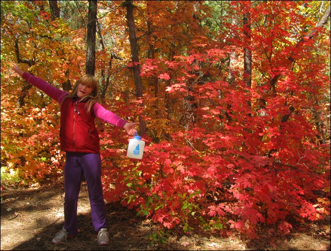
Fourth of July Canyon is always a surprise to many visitors who can’t believe this amount of colorful leaf color is located in New Mexico and not New England.

IMG_6086

But New Mexico is a very diverse state geographically and is more than just brown desert. So much more!
IMG_6088

These are not my GPS maps, because I forgot to bring mine for the hike. But these give an idea of the route we took, although our route was a little longer because we added 2 extra trails for a total mileage of 7 miles hiked(!), and an elevation gain of over 1,000ft (!):

GPS Track Map of 4th of July Canyon Trail and Cerro Blanca Trail

GPS Track Map and Trip Report of Fourth of July Canyon Trail


This is a page from my Hiking New Mexico book.

IMG_6278

We decided to make a loop and hike up Fourth of July Canyon Trail (#173) from the campground. We then turned right and took a side trip up along the Manzano Crest Trail (#170), and then we descended down to Cerro Blanco Trail (#79), following it until the trail ended at Forest Rd 55. And then we hiked along Forest Rd 55 (Tajique Canyon) returning to Fourth of July Campground.

IMG_6276

But first we explored the Crimson Maple Trail (1/2 mile) and the Spring Loop Trail (1/4 mile) which both connected to the Fourth of July Canyon Trail.

JennaNMe6

Jen liked this bent tree and thought it made a fine bench.

IMG_6094

I was very grateful that Kendra took lots of photos, too, including some photos of me and my daughter together.

JennaNMe

The leaf colors were so vibrant it felt magical to be surrounded by so much beauty. We had a lot of fun hiking together.

JennaNMe3


We stopped for a snack break…..

JennaNMe8


I had bought Jen some Whoppers and Kendra shared some of her watermelon with her. Jen ate them together and was excited about creating a new recipe: Whoppermelons!

JennaNMe9

And then we continued on down the Spring Loop Trail.

IMG_6101

JennaNMe10

And soon we came to the trail junction with Fourth of July Canyon….

IMG_6104

We passed through the hiker stile, installed to keep livestock out of the campground.

IMG_6111

I have a special affection for tree tunnels. And I can’t wait to ride Apache here next Autumn!

IMG_6117

Kendra and I asked Jen to take a photo of us. I think she did a pretty nice job, don’t you?

JennaNMe12

Hiking up into Fourth of July Canyon…lots of vibrant color all around us.

JennaNMe7

We’re heading up on the Fourth of July Trail towards Cerro Blanco Trail. The Spur Trail leads towards the Equestrian Campground Trailhead and the Albuquerque Trail is a popular equestrian trail (you can see it on the map I posted above).

IMG_6105

Looking back on the trail we just hiked up, which leads back towards the Fourth of July Campground.

IMG_6119

Kendra thought it would be fun to decorate the sign with my hat and trekking poles….

TrailSign2

Hiking with Kendra is fun!

IMG_6123

Jen may not be smiling, but she was really enjoying herself. She loves to be outdoors and enjoys camping and hiking.

JennaNMe14

Beside the trail is a little creek that gurgles with the water from the Springs up above the canyon.

IMG_6136

Everything is so green, lush and moist up here. 

IMG_6134

When we ride through here it will be good to have a short horse!

IMG_6140

Kendra captured my euphoric mood while surrounded by so much natural beauty.

LisaLeaves1

Dobbie thoroughly enjoyed exploring the canyon and climbing on rocks and logs.

IMG_6132

We were all impressed by the tall Ponderosas along the trail. This one will probably fall in a year or two.

LisaLeaves2

We stopped for lunch beside the livestock water tank at the top of the canyon and enjoyed listening to the water pouring from the Spring, into the tank.

LisaLeaves3

Nature’s Autumn Art

IMG_6144


Playing Hide and Seek…….

LisaLeaves4


Kendra and I couldn’t get enough of the beautiful leaf color. We stopped often to take photos.

IMG_6151

Happy to be outdoors hiking in nature’s splendor!

LisaLeaves6


Jen made it a point to climb most of the boulders beside the trail.

IMG_6148 

Boulders make great places to sit and rest, too.

IMG_6156

We’re turning right and hiking up to the Manzano Mountains Crest on the Crest Trail.

IMG_6161

We decided to follow the Stock By-Pass Detour. Good thing, too as the main trail has quite an impressive set of boulder steps, which I’ll share a photo of in my next post.

IMG_6163

The Stock By-Pass Trail was absolutely gorgeous and covered in a cacophony of amazing colors!

IMG_6165

We were so thrilled about the beautiful carpet of colorful leaves at our feet that we decided to stop and play for a while!

IMG_6167

                                             Beautiful colors!!!

IMG_6168

We’re following the Crest Trail to the right towards the Isleta Indian Reservation….

IMG_6171

We made it to the Crest!!! Guadalupe Peak is in the distance and Mosca Peak is right behind us. We’re standing at 9,085 feet elevation!

LisaLeaves7

Kendra is in love with these high places and enjoying the beauty all around us.

IMG_6180

Mosca Peak! Albuquerque Trail, the equestrian trail, circles around behind Mosca Peak. The hill is covered in golden Shrub Oaks.

IMG_6178

The views out towards the East are of the Estancia Valley and the Salt Mission Trail and Salt Flats.

IMG_6202

The vistas towards the northwest are of Isleta Pueblo, Los Lunas and Albuquerque (beyond that ridge)

IMG_6185

It was a little hazy this day, but the views towards the southwest are of the Manzano Mountain foothills.

IMG_6190

We had the Crest to ourselves, and once we climbed out of Fourth of July Canyon we only saw two other hikers. Dobbie Girl enjoyed being off leash and checking out the views from a boulder.

IMG_6196


It was exhilarating to be up so high. It felt like we were flying with eagles……..

IMG_6182


Coming up next: Cerro Blanco Trail ~ The Hike Down